View GPX file elevation in 3D
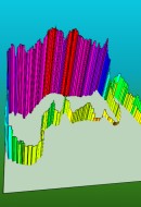
 This page allows you to display a 3D representation of a GPX file recorded with your GPS (using maplorer or any other software writing GPX files, which is pretty much standard).
The elevation profiles are displayed based on on the data in your file; if it does not contain elevation data, this will not work.
In this case, or if you want to see your track on a map, use 2D gpx displayer instead.